Wednesday 21 September 2011

GIS Cloud Starts HTML5 Mapping Revolution!

0 comments

GIS Cloud Starts HTML5 Mapping Revolution! 


  One of the biggest benefits of vector mapping is interactivity. The map is not just a flat raster anymore, it’s a fully interactive surface. Each object can be clicked and styled dynamically, and gives hover feedback!


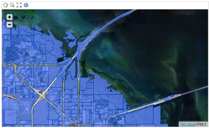
  HTML5 is great for mapping not only because it can render maps very quickly, but also because it is a standard. It works on the desktop, on the web, on smartphones and on tablets which means your GIS can work on those devices as well! No need to build native apps for each of those platforms, with HTML5 you get high performance right from the browser.

Thursday 15 September 2011

Are the Ice Sheets shrinking??

0 comments


According to the Times Comprehensive Atlas Of The World the Greenland ice sheet and Aral Sea are shrinking. But is this just an error on their part by misinterpreting ice sheet data. There's already much debate amongst glaciologists I know.